-
×
 1 × $77.95
 -
×
 Lint Remover,Clothes Shaver - Extra Long 68" Electric Cord Operated Fabric Shaver- Fuzz & Fluff Remover - Suitable to Use on Pilling Surfaces,Such As Sweater,Coat,Carpet,Glove and More
2 × $25.95
Lint Remover,Clothes Shaver - Extra Long 68" Electric Cord Operated Fabric Shaver- Fuzz & Fluff Remover - Suitable to Use on Pilling Surfaces,Such As Sweater,Coat,Carpet,Glove and More
2 × $25.95 -
×
Attmu 50 PCS Reusable Fastening Cable Ties, Microfiber Cloth 6-Inch Hook and Loop Cord Ties, Black A-50 Black
1 × $13.95
-
×
Intex Hose Conversion Adapters Kit
1 × $15.95
-
×
WLPackaging 3/16 700 ft x 12" Small Bubble Cushioning Wrap, Perforated Every 12"
1 × $34.95
-
×
Saliva Drug Test Kit 5 Panel Oral Cube (pack of 2)
2 × $18.95
-
×
Wiz Khalifa RAW Classic Natural Unrefined Pre-rolled Supernatural Cone 12" Long (1 Cone)
1 × $11.95
-
×
Simply Genius (Single Roll) Patterned Duct Tape Roll Craft Supplies for Kids Adults Colored Duct Tape Colors, Panda Party
1 × $16.95
-
×
Alcoholmeter / Hydrometer / Glass Test Cylinder
1 × $28.94
-
×
Foryee Cute Frog Potty Training Urinal for Boys with Funny Aiming Target - Blackish Green
1 × $13.95
-
×
MTech USA MT-632 Series Fixed Blade Tactical Neck Knife, 6-Inch Overall Green Handle Double-Edge Blade
1 × $10.95
-
×
SZCO Supplies Brass Crusader Helmet
1 × $54.95
-
×
 Haribo Roulettes 7/8 Oz. Rolls 36-Count Box 31.5 Ounce
1 × $16.95
Haribo Roulettes 7/8 Oz. Rolls 36-Count Box 31.5 Ounce
1 × $16.95 -
×
Organic Moringa Leaf Powder (16Oz -1Lb). USDA Certified Organic. Raw Green Super Food, Energy Boost, Multivitamin, Healthy Nutrition and Metabolism. Non GMO and Gluten Free. In a Food Grade Container. 16 Oz
1 × $26.95
-
×
BLACK+DECKER WM125 Workmate 125 350-Pound Capacity Portable Work Bench
1 × $46.95
-
×
Reliance 9000429-045 Heavy Duty Heating Element Wrench
1 × $14.95
-
×
 cnsdistributing 6809 Proof and Tralle or% Alcohol Hydrometer Alcoholmeter Spiritometer for Moonshine Still, Spirits, Distilled
1 × $11.95
cnsdistributing 6809 Proof and Tralle or% Alcohol Hydrometer Alcoholmeter Spiritometer for Moonshine Still, Spirits, Distilled
1 × $11.95 -
×
Splenda No Calorie Sweetener Value Pack 1200 Individual Packets 1200 Packets
1 × $28.95
-
×
EPOXY Resin 2 Gallon Kit. for Super Gloss Coating
1 × $122.95
-
×
DESKTOP Wooden Model Kit Trebuchet by Young Modeler
1 × $24.95
-
×
 Fiskars 7.9-12 Foot ExtendableTree Pruning Stik Pruner (92406935K) Pack of 1
1 × $119.95
Fiskars 7.9-12 Foot ExtendableTree Pruning Stik Pruner (92406935K) Pack of 1
1 × $119.95 -
×
BLACK+DECKER AF-100-3ZP String Trimmer Replacement Spool with 30 Feet of .065-Inch Line
1 × $17.95
-
×
Triple Scale Hydrometer And Test Jar Combo Brewing Kit Supplies - Hydrometers..
1 × $24.95
-
×
Tram 1607-HC 46-Inch VHF Marine Antenna One Size
1 × $40.95
-
×
Good Smile The Legend of Zelda: Skyward Sword Link Figma Action Figure Standard Packaging
1 × $72.95
-
×
Anker Ergonomic Optical USB Wired Vertical Mouse 1000/1600 DPI, 5 Buttons CE100
1 × $20.95
-
×
Ecosmart HE HE 90240 ECO 27 Replacement Part
1 × $44.95

 Lint Remover,Clothes Shaver - Extra Long 68" Electric Cord Operated Fabric Shaver- Fuzz & Fluff Remover - Suitable to Use on Pilling Surfaces,Such As Sweater,Coat,Carpet,Glove and More
  Attmu 50 PCS Reusable Fastening Cable Ties, Microfiber Cloth 6-Inch Hook and Loop Cord Ties, Black A-50 Black
  Intex Hose Conversion Adapters Kit
  WLPackaging 3/16 700 ft x 12" Small Bubble Cushioning Wrap, Perforated Every 12"
  Saliva Drug Test Kit 5 Panel Oral Cube (pack of 2)
 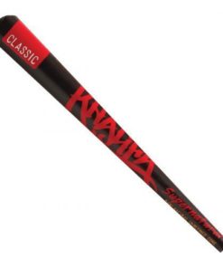 Wiz Khalifa RAW Classic Natural Unrefined Pre-rolled Supernatural Cone 12" Long (1 Cone)
  Simply Genius (Single Roll) Patterned Duct Tape Roll Craft Supplies for Kids Adults Colored Duct Tape Colors, Panda Party
  Alcoholmeter / Hydrometer / Glass Test Cylinder
  Foryee Cute Frog Potty Training Urinal for Boys with Funny Aiming Target - Blackish Green
  MTech USA MT-632 Series Fixed Blade Tactical Neck Knife, 6-Inch Overall Green Handle Double-Edge Blade
  SZCO Supplies Brass Crusader Helmet
  Haribo Roulettes 7/8 Oz. Rolls 36-Count Box 31.5 Ounce
  Organic Moringa Leaf Powder (16Oz -1Lb). USDA Certified Organic. Raw Green Super Food, Energy Boost, Multivitamin, Healthy Nutrition and Metabolism. Non GMO and Gluten Free. In a Food Grade Container. 16 Oz
 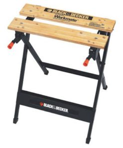 BLACK+DECKER WM125 Workmate 125 350-Pound Capacity Portable Work Bench
  Reliance 9000429-045 Heavy Duty Heating Element Wrench
 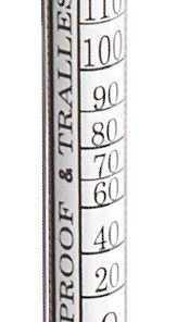 cnsdistributing 6809 Proof and Tralle or% Alcohol Hydrometer Alcoholmeter Spiritometer for Moonshine Still, Spirits, Distilled
  Splenda No Calorie Sweetener Value Pack 1200 Individual Packets 1200 Packets
 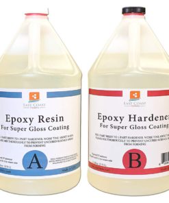 EPOXY Resin 2 Gallon Kit. for Super Gloss Coating
  DESKTOP Wooden Model Kit Trebuchet by Young Modeler
  Fiskars 7.9-12 Foot ExtendableTree Pruning Stik Pruner (92406935K) Pack of 1
  BLACK+DECKER AF-100-3ZP String Trimmer Replacement Spool with 30 Feet of .065-Inch Line
 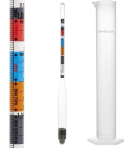 Triple Scale Hydrometer And Test Jar Combo Brewing Kit Supplies - Hydrometers..
  Tram 1607-HC 46-Inch VHF Marine Antenna One Size
  Good Smile The Legend of Zelda: Skyward Sword Link Figma Action Figure Standard Packaging
  Anker Ergonomic Optical USB Wired Vertical Mouse 1000/1600 DPI, 5 Buttons CE100
  Ecosmart HE HE 90240 ECO 27 Replacement Part
![Appalachian Trail: East Mountain to Hanover Map [Vermont] (National Geographic Topographic Map Guide, 1510) Map, Folded Map](https://swiftsly.com/wp-content/uploads/2023/12/91yjMNkk5VL.jpg "Appalachian Trail: East Mountain to Hanover Map [Vermont] (National Geographic Topographic Map Guide, 1510) Map, Folded Map 1")
![Appalachian Trail: East Mountain to Hanover Map [Vermont] (National Geographic Topographic Map Guide, 1510) Map, Folded Map - Image 2](https://swiftsly.com/wp-content/uploads/2023/12/912ODHxYt1L.jpg "Appalachian Trail: East Mountain to Hanover Map [Vermont] (National Geographic Topographic Map Guide, 1510) Map, Folded Map 2")
![Appalachian Trail: East Mountain to Hanover Map [Vermont] (National Geographic Topographic Map Guide, 1510) Map, Folded Map - Image 3](https://swiftsly.com/wp-content/uploads/2023/12/B1zVjnSF8LS.jpg "Appalachian Trail: East Mountain to Hanover Map [Vermont] (National Geographic Topographic Map Guide, 1510) Map, Folded Map 3")
![Appalachian Trail: East Mountain to Hanover Map [Vermont] (National Geographic Topographic Map Guide, 1510) Map, Folded Map - Image 4](https://swiftsly.com/wp-content/uploads/2023/12/71N4U73hQRL.jpg "Appalachian Trail: East Mountain to Hanover Map [Vermont] (National Geographic Topographic Map Guide, 1510) Map, Folded Map 4")
![Appalachian Trail: East Mountain to Hanover Map [Vermont] (National Geographic Topographic Map Guide, 1510) Map, Folded Map - Image 5](https://swiftsly.com/wp-content/uploads/2023/12/712vpqqWciL-1.jpg "Appalachian Trail: East Mountain to Hanover Map [Vermont] (National Geographic Topographic Map Guide, 1510) Map, Folded Map 5")

 Map, Folded Map 6")
 Map, Folded Map 7")
 Map, Folded Map 8")
 Map, Folded Map 9")
 Paperback 10")

Appalachian Trail: East Mountain to Hanover Map [Vermont] (National Geographic Topographic Map Guide, 1510)
Description
• Waterproof • Tear-Resistant • Topographic MapThe East Mountain to Hanover
Topographic Map Guide makes a perfect traveling companion when traversing the
Vermont section of the Appalachian Trail (A.T.). The landscape of Vermont is a
variety of wooded mountains, forests of white pine and paper birch, and
rolling terrain dotted by fields and pastures. To the north and east, the A.T.
crosses short, steep hills and overgrown farmlands that characterize the
Connecticut River valley. Farther south is the rugged and rocky high country
of the Green Mountains.Each A.T. Topographic Map Guide includes detailed
topographic maps at a detail of 1 inch = 1 mile. Each page is centered on the
A.T. and overlaps with the adjacent pages so there is little chance of getting
lost. Along the bottom of each page is a trail profile that shows the distance
between shelters, camping areas, and trail access points. The map and trail
profile provide a step by step visual guide to hiking the trail, mile by
rugged mile. The Topographic Map Guide is built for all levels of hiking
enthusiasts, from the day tripper to the multi month ‘thru-hiker’. The front
pages of the printed Topographic Map Guide include resupply information, town
inset maps, camping options, and much more.Every Topographic Map Guide is
printed on “Backcountry Tough” waterproof, tear-resistant paper. A full UTM
grid is printed on the map to aid with GPS navigation.Other features found on
this map include: Bennington, Big Branch Shelter, Bromley Mountain, Bromley
Shelter, Churchill Scott Shelter, Clarendon Shelter, Clarksburg State Forest,
Congdon Shelter, Cooper Lodge Shelter, Glastenbury Mountain, Goddard Shelter,
Governor Clement Shelter, Green Mountain National Forest, Greenwall Shelter,
Hanover, Happy Hill Shelter, Kid Gore Shelter, Killington Peak, Lebanon,
Little Rock Pond Shelter, Lost Pond Shelter, Manchester Center, Melville
Nauheim Shelter, Minerva Hinchey Shelter, North Adams, Norwich, Peru Peak
Shelter, Pico Camp Shelter, Rutland, Seth Warner Shelter, Spruce Peak Shelter,
Stony Brook Shelter, Story Spring Shelter, Stratton Mountain, Stratton Pond
Shelter, Thistle Hill Shelter, Velvet Rocks Shelter, Wallingford, White River
Junction, William B. Douglas Shelter, Winturri Shelter, Woodstock.Map Scale =
1:63,360Folded Size = 4.25″ x 9.25″ Read more
Features:
Product Details:
- Publisher : Natl Geographic Society Maps; 2022nd edition (January 1, 2022)
- Language : English
- Map : 44 pages
- ISBN-10 : 1597756474
- ISBN-13 : 71
- Item Weight : 2.89 ounces
- Dimensions : 4.1 x 0.3 x 9.3 inches
- Best Sellers Rank: #510,785 in Books (See Top 100 in Books) #486 in United States Atlases & Maps (Books) #510 in Maps (Books) #1,534 in Hiking & Camping Excursion Guides (Books)
- #486 in United States Atlases & Maps (Books)
- #510 in Maps (Books)
| Dimensions | 9.33 × 4.25 × 0.24 in |
|---|---|
| Ean | 9781597756471 |
| Mpn | TI00001510 |
| Upc | 749717915107 |
| GTIN | 09781597756471 |
| Isbn | 1597756474 |
| ISBN10 | 1597756474 |
| ISBN13 | 9781597756471 |
| Brand | Natl Geographic Society Maps |
| Format | Map, Folded Map |
PAYMENT POLICY
SHIPPING POLICY
Most items are shipped within one business day via UPS within the Continental United States.
- Canada shipment can take up to 10 days
- Alaska, Hawaii, and Puerto Rico shipment can take up to 10 days, and some items may not be permitted to ship to these locations.
- If any shipment is not permitted to your area, full refund will be issued within two business days.
RETURNS POLICY
All returns accepted within 30 days after receiving the item.
- Refund given as money back (no exchanges)
- Return Shipping to be paid by buyer, unless item defective or damaged.
- 15% Restocking fee applies unless return due to defective or damaged product.
- Perishable or Hazardous Goods are not returnable. Returns may require compliance with Manufacturer policies.
FEEDBACK
We take our reputation seriously. We buy and sell online, so we understand the value of trust. If you are unsatisfied with your order for any reason, please Contact Us and we will work with you to resolve it to your satisfaction.
Related products
-35%

Original price was: $22.90.$14.95Current price is: $14.95.
-31%

-27%

Original price was: $29.90.$21.95Current price is: $21.95.
-24%

Original price was: $32.90.$24.95Current price is: $24.95.
-15%

-22%

Original price was: $40.90.$31.95Current price is: $31.95.
-15%

-12%
Original price was: $93.90.$82.95Current price is: $82.95.
![Appalachian Trail: East Mountain to Hanover Map [Vermont] (National Geographic Topographic Map Guide, 1510) Map, Folded Map](https://swiftsly.com/wp-content/uploads/2023/12/91yjMNkk5VL-100x100.jpg)